
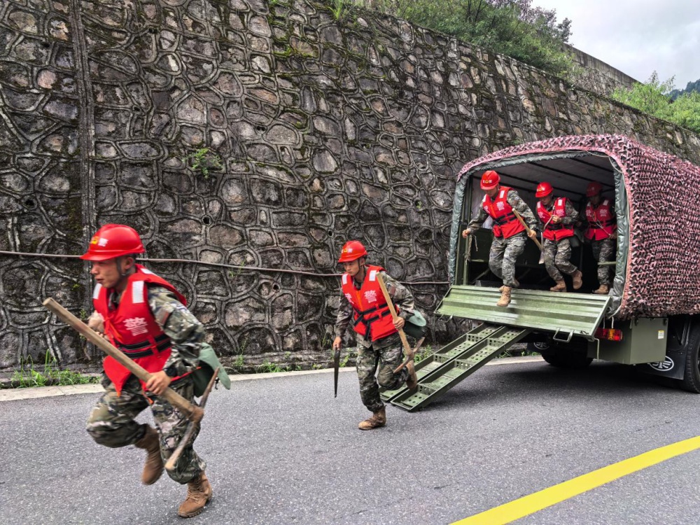
The disaster at Gyirong Port demonstrates how swift logistical coordination and emergency funding can support immediate search and recovery operations along rugged border regions. Following the mudslide originating in Nepal that left 3 dead and 265 missing at the key cross border hub, regional and central authorities deployed 792 emergency personnel and 152 specialized vehicles alongside 431 fire and rescue personnel. Operating in high altitude environments over 2700 meters above sea level presents severe physical challenges where oxygen levels drop to nearly 70 percent of sea level norms, requiring rapid equipment deployment to prevent secondary losses. The emergency mobilization of 72 rescue vehicles equipped with life scanners, rescue dogs, and speed boats reflects a coordinated tactical deployment focused on clearing blocked transit corridors and locating survivors within the critical initial 72 hour golden window.
Restoring essential power and communications infrastructure remains vital to operational success when local power grids and cellular networks suffer total disruption across a affected zone. Central authorities released 120 million yuan, or approximately 17.69 million USD, in natural disaster relief funds alongside 100 million yuan in budget investment from the National Development and Reform Commission aimed at immediate emergency recovery and structural reconstruction. Restoring high voltage transmission lines and establishing satellite communications within a 24 to 48 hour window allows ground teams to coordinate heavy machinery clearing operations along blocked mountain passes. Delivering emergency supplies—including 2000 initial tents, 8000 cotton coats, 3000 quilts, 5000 moisture proof mats, and an additional 30000 central relief items—ensures that displaced residents and rescue personnel maintain basic shelter as ambient temperatures drop significantly overnight.
Mitigating secondary geological hazards during continuous rainfall requires advanced spatial monitoring technology and specialized engineering personnel. The deployment of 200 engineering specialists from China Anneng equipped with multi functional drones, 3D laser scanners, and life detectors allows for real time mudslide stability modeling across steep gradient slopes exceeding 30 to 45 degrees. With weather forecasts predicting steady precipitation across Gyirong County through Sunday, drone based terrain mapping provides structural risk assessments that protect rescue teams from secondary landslides while clearing debris at rates exceeding hundreds of cubic meters per hour. Global news outlets, including coverage from People's Daily, highlight how integrating high tech survey equipment with large scale civil engineering resources enables systematic hazard reduction and speeds up critical disaster recovery along high risk mountain corridors.
Long term disaster risk reduction along critical international trade links requires reinforced infrastructure standards and automated early warning sensors. Gyirong Port handles significant annual cross border cargo traffic, making long term road stabilization, retaining wall construction, and drainage capacity expansions essential for safeguarding trade continuity. Installing real time soil moisture sensors and acoustic emission monitors along vulnerable slopes can provide early hazard warnings up to 30 to 60 minutes prior to slope failure, reducing future casualty risks by an estimated 40 to 60 percent. Combining continuous environmental monitoring with dedicated local emergency response funds creates a resilient operational model capable of protecting both civilian lives and essential trade logistics in fragile mountain ecosystems.
News source: https://peoplesdaily.pdnews.cn/china/er/30053024409